March 9
Area:
Cardiff, Mineral
Location:
Alta guard station to Cardiff pass to the eyebrow to Cardiac ridge to Cardiac bowl to Mill B south to Mineral out Mineral.
Elevations, slope angles and aspects:
7000’-11000’, angles to 40°, all aspects.
Avalanche activity:
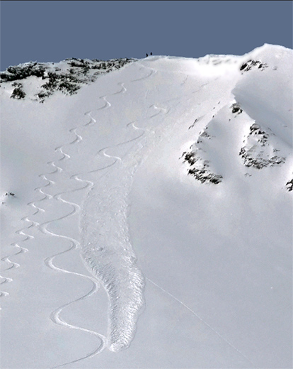
A cornice fall triggered a new snow soft slab off the ridge on Cardiac ridge, southeast facing 20’ wide running a few hundred feet. Probably near the end of yesterday’s storm. I ski cut out a small wind drift on the east facing, same area. 20’ wide, running minimal distance.

Another ski cut on the entry into upper mineral from Mill B got another small soft slab to move, which continued downhill several hundred vertical, somewhat surprising. There was wet activity, with sun warming beginning on the southeast facing under the rocks on Cardiac ridge by around 10:30 am. I’d imagine this followed the compass but, increasing cloud cover limited the activity on west facing in the afternoon. The wet activity noted was small rollers and point releases. No other activity.
Slopes skied:
Keyhole skier’s left of the eyebrow on Power line ridge, Cardiac ridge from the top, Cardiac bowl from the top, entry into Mill B south from the summit of Superior and Mineral fork from Mill B south, north facing.
Snow surface and conditions:
There was 4-6” on the approach to Cardiff, some crusting. Upper Cardiff had about 8” of dense snow over a variable base much of that crusted except for the due north facing. Mineral and lower elevations had somewhat less new snow. There were shallow drifts scattered around mostly small and patchy. No sluffing, minimal avalanche activity, no cracking and no collapsing.
Weather:
Mostly clear and sunny in the morning, with increasing high clouds. Little wind. Moderate temperatures.
Evaluation:
Warm temperatures for several days followed by cooling and a bit of new snow seem to have capped off the deeper instabilities for the present, certainly in the terrain covered today. There was minimal activity from the storm snow and I’d guess it has mostly stabilized, with a bit of green housing and a bit of sun and heat. The forecast storm and snow amounts should not change the stability other than adding a few more wind drifts if the winds occur as forecast and we get the forecast snow. I’d expect some lingering isolated hazard in deeper weak layering but, need a significant load or a no freeze in the spring to create another widespread slide cycle.
© wowasatch.com